Parks
Louisville Kentucky is known as the City of Parks for good reason. Louisville's park system is the last designed by Frederick Law Olmsted, the 'Father of American Landscape Architecture,' and one of only five such systems across the country.
On February 22, 2005, Mayor Jerry Abramson and Metro Parks announced a multi-million dollar, multi-year initiative to add thousands of acres of park land and protected green space to Louisville Metro's "greenprint."This effort builds upon the groundwork laid by famed landscape architect Frederick Law Olmsted over a century ago, and will complete Louisville's transformation into a City of Parks.
The City of Parks initiative includes:
- Acquisition and development of new park land:
- Floyds Fork Greenway Project – an effort led by 21st Century Parks to create a new system of parks, trails and open spaces along Floyds Fork, from Shelbyville Road to Bardstown Road.
- A paved Louisville Loop trail of more than 100 miles around the community that will tie together Louisville's diverse parks and neighborhoods.
- An unprecedented level of capital investment to improve existing parks .
- Opportunities for park users to get involved .
Louisville's park system is the last designed by Frederick Law Olmsted, the "Father of American Landscape Architecture", and one of only five such systems across the country. Known nationally as the defining park system of his career, it stands today as one of his best-preserved works, reflecting the genius of Olmsted's vision.
Louisville’s Olmsted parks and parkways form a unique component to the fabric of the city, a contributing factor to the quality of life for all citizens. One hundred years after the first Olmsted recommendations for Cherokee, Iroquois and Shawnee, the value of the clearly-planned system of large landscaped parks connected by tree-lined parkways, and smaller parks, playgrounds, and squares is greater than ever. In one way or another parks have the ability to improve almost every aspect of life for individuals and the community at large. Caring for these historic treasures and seeing that they remain a valuable assets for our community is the heart of the work undertaken by the Olmsted Conservancy.
Flagship Parks
Cherokee Park (Willow Avenue and Cherokee Parkway)
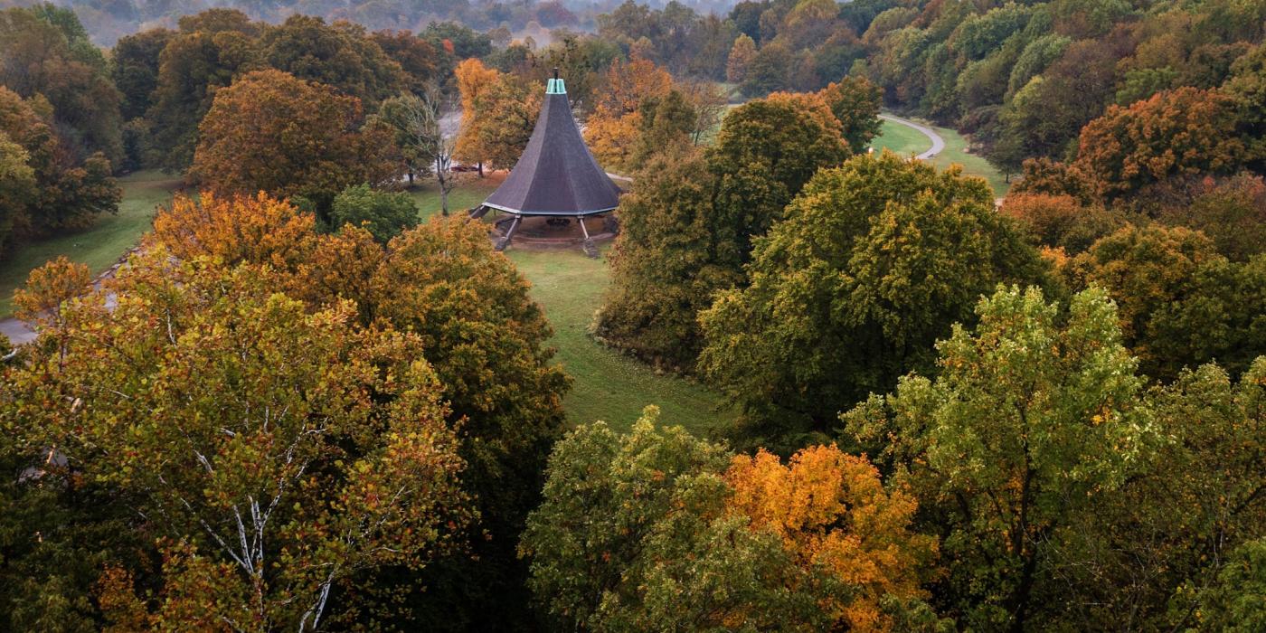
Designed by Olmsted to be a place where one could experience scenery and take in the refreshment offered by the landscape. It is characterized by long winding roads opening to beautiful vistas, and large open spaces set in the valley of Beargrass Creek. The gently rolling slopes extending uphill from the creek were shaped from pasture lands to contain individual shade trees and tree groves. Woodland areas were incorporated into the design and edge plantings were added to soften the transition from open space to woodland.
park map
Iroquois Park (Southern Parkway & Taylor Boulevard)
Noted by early park users as Louisville’s own “Yellowstone”, the Olmsted designs take advantage of the rugged terrain and the drama of the mature woodlands and scenic overlooks. At the heart of the park is a 10,000-year-old forest, that blankets the knob’s steep hillsides with a great variety of rare plants and animals. The circulation through the park includes a network of pedestrian paths, bridle trails, and circuit drives. The lands were set aside as a preserve and developed for access and enjoyment with the forests remaining essentially intact.
park map
Shawnee Park (Southwestern Parkway & Broadway)
The Olmsted plan for Shawnee used the low-lying riverfront setting and topography of the land as inspiration for the park’s design. The two principal features of the park are the concourses that afford extensive views and the expansive Great Lawn. Intended as Louisville’s spot for large formal gatherings, the Great Lawn is enclosed with border plantings and a tree-lined circular drive. This open space was adaptable for both large gatherings and sports uses. The park contained the only formal garden in Louisville’s system and for a time employed full time gardeners.
park map
Parks, Squares and Playgrounds
Algonquin Park (Cypress Street & Burwell Avenue)
Design for this park began in 1928 and continued until 1935. The sixteen acre park serves the neighborhood with both recreational facilities and open spaces.
street map
Baxter Square (12 & Jefferson Streets)
Louisville’s first park dedicated in 1880. The Olmsted firm made recommendations for improvements to the urban green space in 1892.
street map
Bingham Park (Coral Avenue & Brownsboro Road)
Designed in 1913 this small park was originally known as Clifton Park. Like other smaller neighborhood parks, it accommodates an array of active recreational facilities.
street map
Boone Square (20th & Rowan Streets)
Land purchased from the Boone family in the early 1890’s was enhanced according to recommendations by the Olmsted. The park features a rustic stone wall with elaborate border plantings.
street map
Central Park (Fourth & Magnolia Avenues)
The sixteen acre Central Park in Old Louisville was purchased from the duPont family in 1904. It is characterized by elaborate walkways and border plantings which focus attention on the pergola that dominate the high ground in the center of the park.
street map
Chickasaw Park (Southwestern Parkway & Greenwood)
The Olmsted Brothers began producing a plan for this sixty-one acre site in 1923. Complete with winding paths, a wading pool, and tennis courts the park plan was not fully implemented until the 1930’s.
street map
Elliott Park (28th & Magazine Streets)
Designed in the early 1900’s, this four acre neighborhood park features recreational facilities and play areas.
street map
Seneca Park (Pee Wee Reese & Taylorsville Roads)
The last of the parks designed in Louisville by the Olmsted firm. The plan, presented in 1928, was in stark contrast to neighboring Cherokee Park because of its formal style and also because the plan included an 18-hole golf course along with many other recreation facilities.
park map
Shelby Park (Oak & Clay Streets)
Perhaps the most formal of all Louisville’s parks. The 16 acre park’s 1907 neoclassical design is consistent with the Beaux Arts style Shelby Park Library Branch, located on the park site. The Olmsted Brothers took great care to arrange the many recreational facilities and accent the park with elaborate border plantings.
street map
Stansbury Park (Third Street and Eastern Parkway)
This small neighborhood park was originally known as Third Street Playground. It’s formal design in 1900 allowed for both playgrounds and tranquil landscaped areas.
street map
Tyler Park (Tyler Park Drive & Baxter Avenue)
Despite its irregular shape and rugged terrain as well as the fact that it is divided by a major street, the 13 acre park designed in 1906 demonstrates a high degree of formalism. More active recreation facilities are concentrated on the eastern side while the western half is devoted to more passive park use.
street map
Victory Park (22nd & Kentucky Streets)
Designed between 1919-1923, this small four acre park served the community by combining recreational facilities with landscaped elements.
street map
Wayside Park (Southern Parkway & Oakdale Avenue)
One of two small green spaces found along the parkway that are designated as parks. Open and uncluttered, Olmsted’s design intended for shrubs to be planted to provide a border for the park screening it from Southern Parkway.
street map
Willow Park (Willow Avenue & Cherokee Parkway)
Originally part of the main entryway into Cherokee Park, the parcel of land that is known as Willow Park achieved its own identity when Willow Avenue was extended to intersect with Cherokee Parkway in 1946.
street map
Olmsted Parkways
Developed over a thirty year period, the green parkway corridors were meant to provide pleasurable driving experiences as one traveled throughout the city. Originally designed to link the flagship parks, the six parkways— Algonquin, Cherokee, Eastern, Northwestern, Southern and Southwestern – today serve as main thoroughfares. Their character is defined by the width of right-of-ways and the spatial organization of the trees, sidewalks and drives that flank them.